

Creating and analyzing the seismomectonic model of Hungary
Get an insight into the structure of the Earth’s crust, learn more about the faults created by past earthquakes and create a model for Hungary that will help in risk assessment and large-scale infrastructure development. Briefly, this is the main aim of the joint research program of the Institute of Earth Physics and Space Science and the GEOMEGA Ltd. The creation of the seismotectonic model of Hungary will be accomplished owing to the support of the excellence program of the National Research, Development and Innovation Office with a grant of HUF 206 million.
From time to time earthquakes occur in Hungary although the vast majority of them are not felt by the residents, events causing major damages are take place only in every 20-30 years. However, this is still an important issue that needs to be addressed: – Although earthquake activity is moderate in the Pannonian Basin, there were historic seismic events that caused serious devastation in the past. Nowadays, a large earthquake may have unpredictable consequences as a result of the highly urbanized environment, says one of the project researchers. For this reason, the consortium participants are convinced that it is essential for researchers to have a better picture on the causes, precursors and generation mechanism of major earthquakes, as well as the process itself and its anticipated consequences.
Nowadays the large amount of structural geophysical and drilling data as well as satellite Earth observation missions provide remarkable development and foster the compilation of the seismotectonic model. The model will base on the comprehensive analysis of the available data sets and provide the active and seismogenic faults on regional-scale, the distribution and focal mechanism of earthquakes epicenters and the most sensitive locations regarding earthquake hazard. Researchers are convinced that the model will prove to be useful both in social and economic aspects as it can serve as a basis for local seismic risk analyzes and strategic planning for infrastructure development and hence mitigating the expected consequences of earthquakes.
The 2018-1.2.1-NKP-2018-00007 project entitled Creating and Analyzing the Seismotectonic Model of Hungary is funded by the National Excellence Program and the grant of HUF 206,358,710 from the National Research Development and Innovation Fund. The consortium leader is the Institute of Earth Physics and Space Science, its partner is the GEOMEGA Ltd. The project started on January 1, 2019 and ends on December 31, 2021.
2020
September 2020
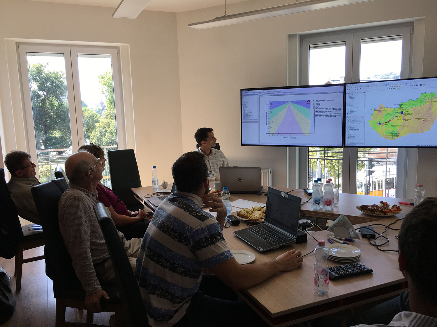
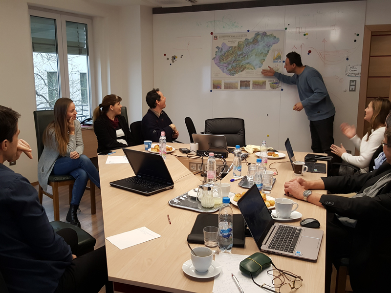
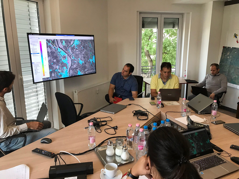
Progress meeting of the project, overview of tasks scheduled for 2020.

June 2020
Presentation of the space geodetic results of the project at the ESA FRINGE conference
May 2020
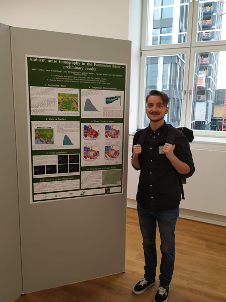
Seismology related results of the NKP SZET project presented at the EGU2020 conference

January 2020
Evaluation of the first year, definition of tasks and work schedule for 2020.
January 2020
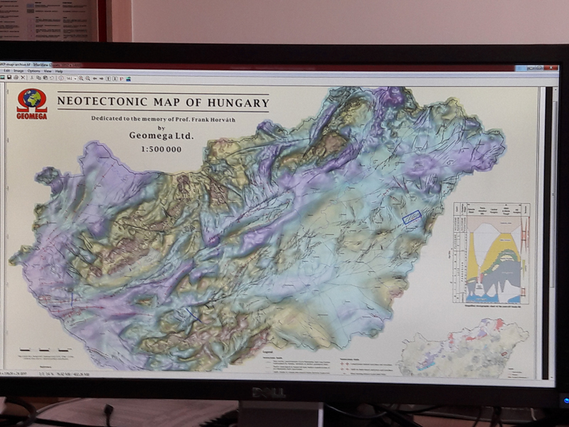
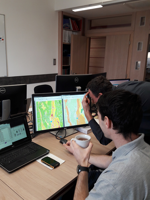
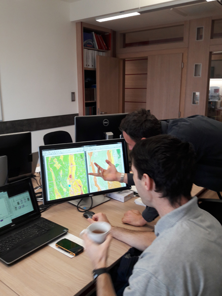
Almost finished: only minor adjustments needed for the new neotectonic map of Hungary
January 2020
Introduction and discussion of the new neotectonic map of Hungary with the project participants (Geomega office, Budapest)
2019
November 2019
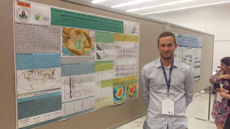
Participation of PhD students at the AlpArray Scientific meeting in Frankfurt
October 2019
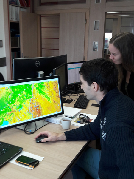
Why it did not occur me earlier? – Analysis of geomorphologic relationships at a potential Vs30 survey site
October 2019
Oh yes, it will be a suitable site… – Analysis of geomorphologic relationships at a potential Vs30 survey site
September 2019
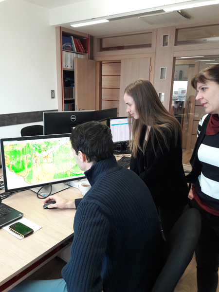
Progress meeting held in September, Budapest. Discussion the first results of Sentinel-1 radar interferometry.
July 2019
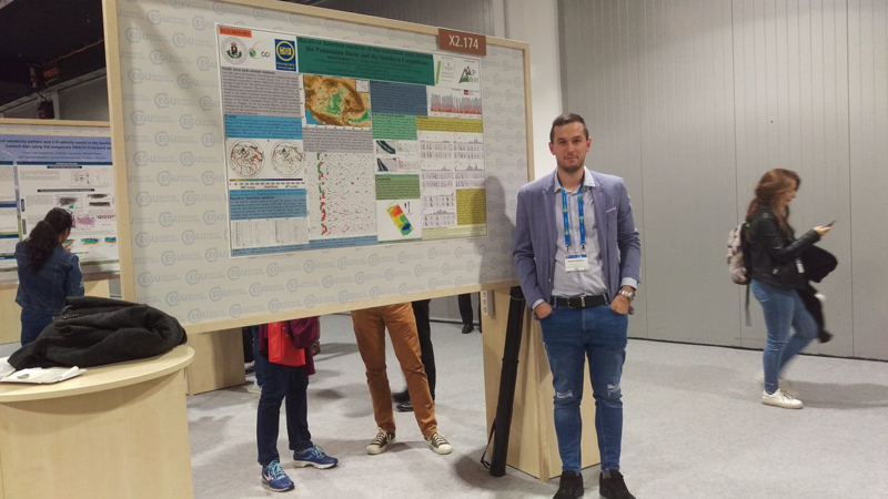
Participation at the IUGG conference held in Montreal, July 2019
July 2019
Final adjustments of the new topographic slope map of Hungary

June 2019
Looking for permanent scatterer candidates for Sentinel-1 radar interferometry. Checking phase unwrapping errors.
June 2019
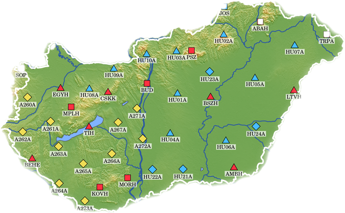
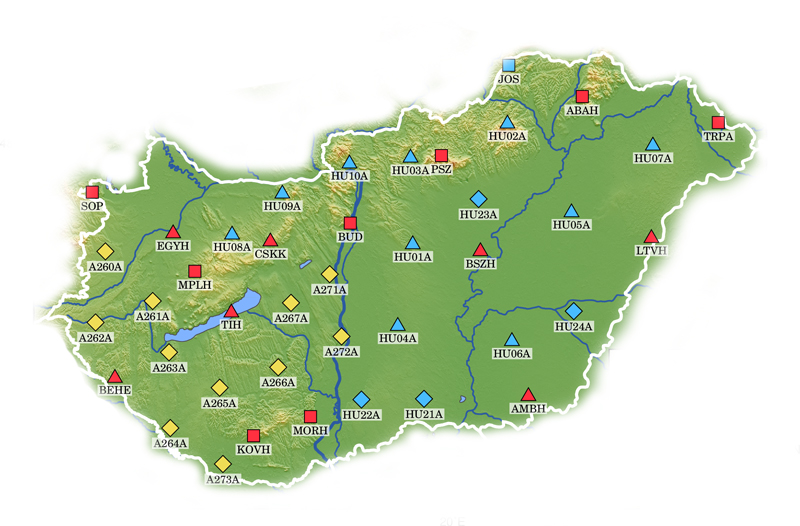
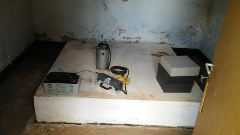
The densified Hungarian Seismological Network, it will form the basis of investigating deep structures by seismic methods.
June 2019
Sentinel-1 integrated benchmark for the investigation of the deformation of the Mid-Hungarian fault zone
May 2019
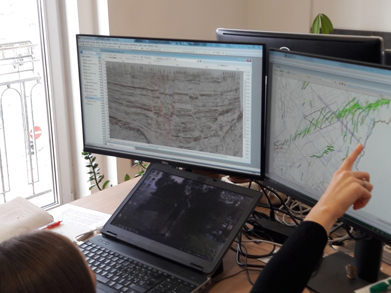
Preparation of the new neotectonic map of Hungary: analysis of a seismic profile from the Derecske through
May 2019
An early version of the new topographic slope map of Hungary and its internal discussion
April 2019
PhD students presenting their research at the European Geoscience Union conference in Vienna, 2019
Marc 2019
Noise level measurements were set out to find right station locations with a stable, low seismic noise level.
March 2019
Preparation of the new neotectonic map of Hungary: analysis of a seismic profile from the Bonyhád basin
January 2019
Kick-off meeting was held January 29 2019 in Sopron. The aim of the project is the determination of the seismotectonic vulnerability in Hungary by analysing and interpreting seismogenic structures connected to neotectonic fault zones, local stress field, more accurate epicenter determinations, surface deformations from space geodesy and local geological effects.